There are plenty of challenging trails and scrambles on the Western face of Mt. Hood. That said, if you choose the McNeil Point Scramble you will not be disappointed. The United States Forest Service has since unlisted the trail from its website, a testament to its difficultly. However, signs still point in the trail’s direction, tempting those who dare to attempt the climb.
The main stretch of the McNeil Point Scramble Trail itself is under half a mile, but averages about 35% grade. This isn’t the only thing that makes the scramble difficult, most the trail’s surface is loose dirt and rock. All this said, for experienced hikers this is certainty a fun, engaging beautiful hike.
The Path to McNeil Point
Your journey begins at a fairly populated trailhead to Top Spur Trail. This short trail will bring you to a five-way trail crossing within a single solitary camping spot where you will receive your permits into the designated wilderness. From this junction take the Timberline Trail through Bald Mountain until you get to the McNeil Point Scramble Trail, which is the meat of your hike.
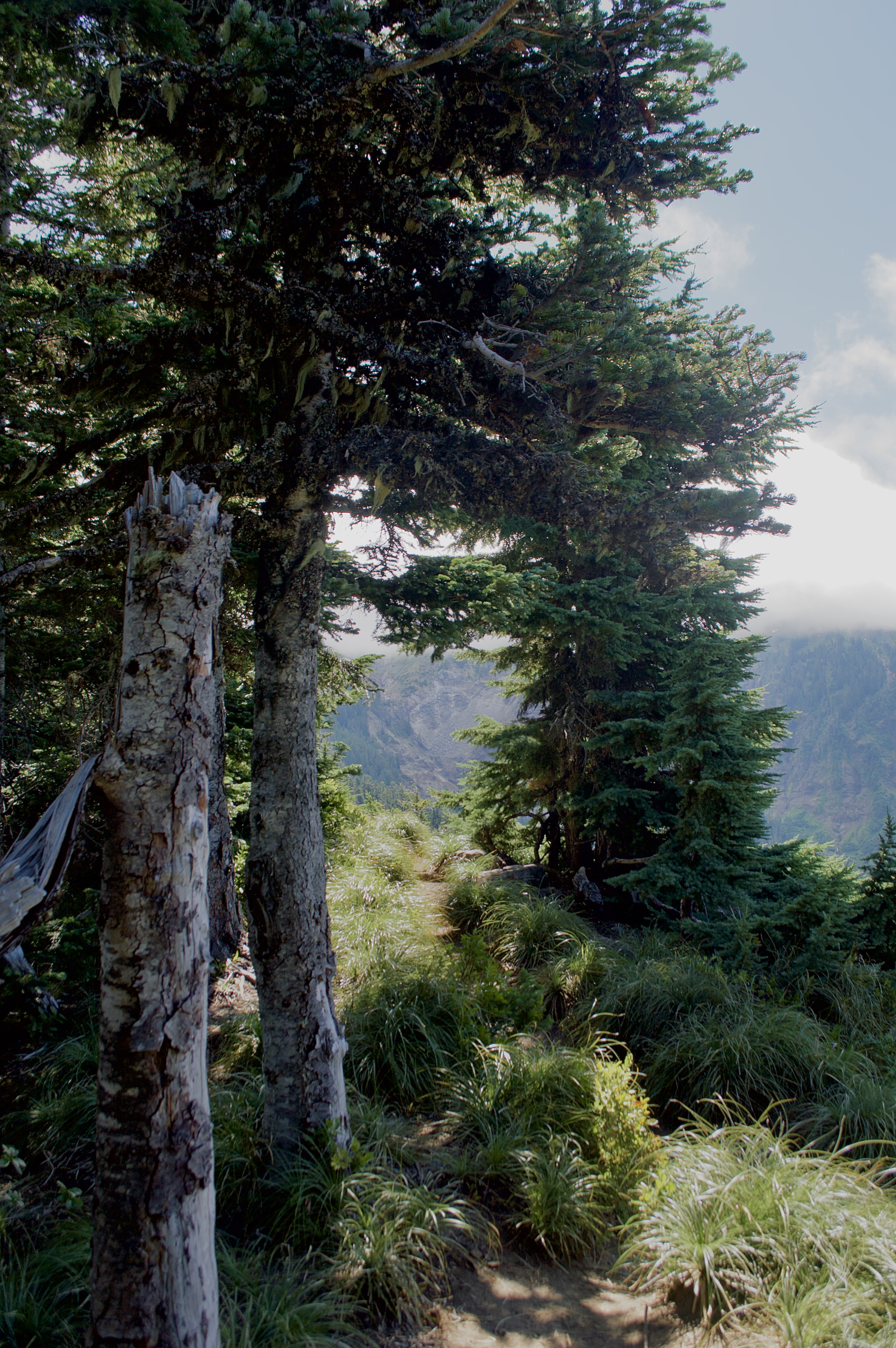
What the view from behind looks like along the McNeil Point Scramble Trail.
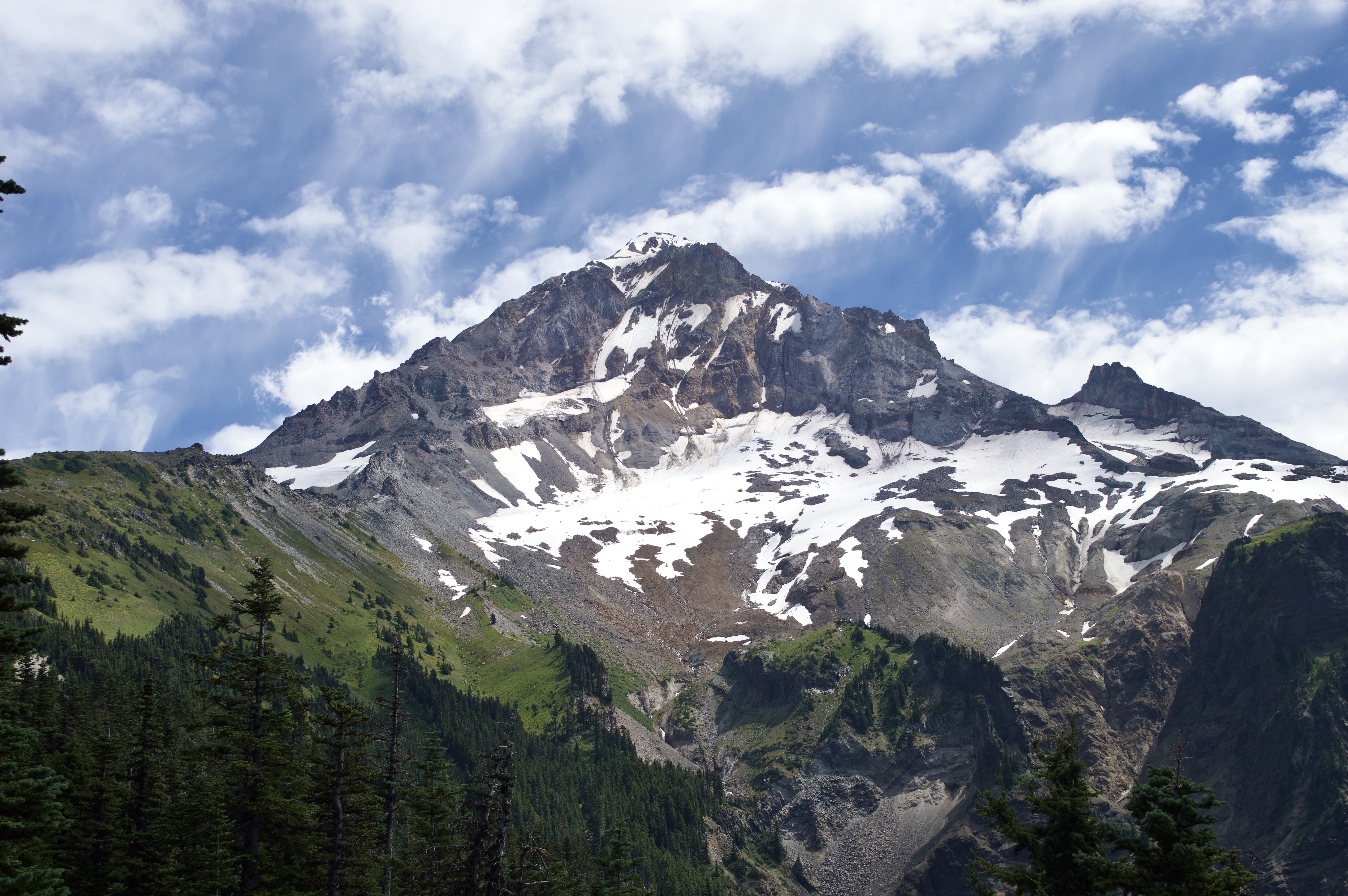
In under half a mile you’ll go from around 5,300 feet to 6,100 feet. However, while this section of your hike is difficult, it is also the hardest. Take your time here and enjoy the views all around you, there is certainly no rush to the top. That said, when you get to the top, you’ll get to see one of the last remaining rock shelters on Mt. Hood as well as a fabulous view of the mountain’s western face.
After you take your time soaking in the beautiful view, follow the trail onto the McNeil Point Trail. You’ll find plenty of rock walls acting as wind and storm barriers for potential campers, which also offer the perfect lunch break spot.
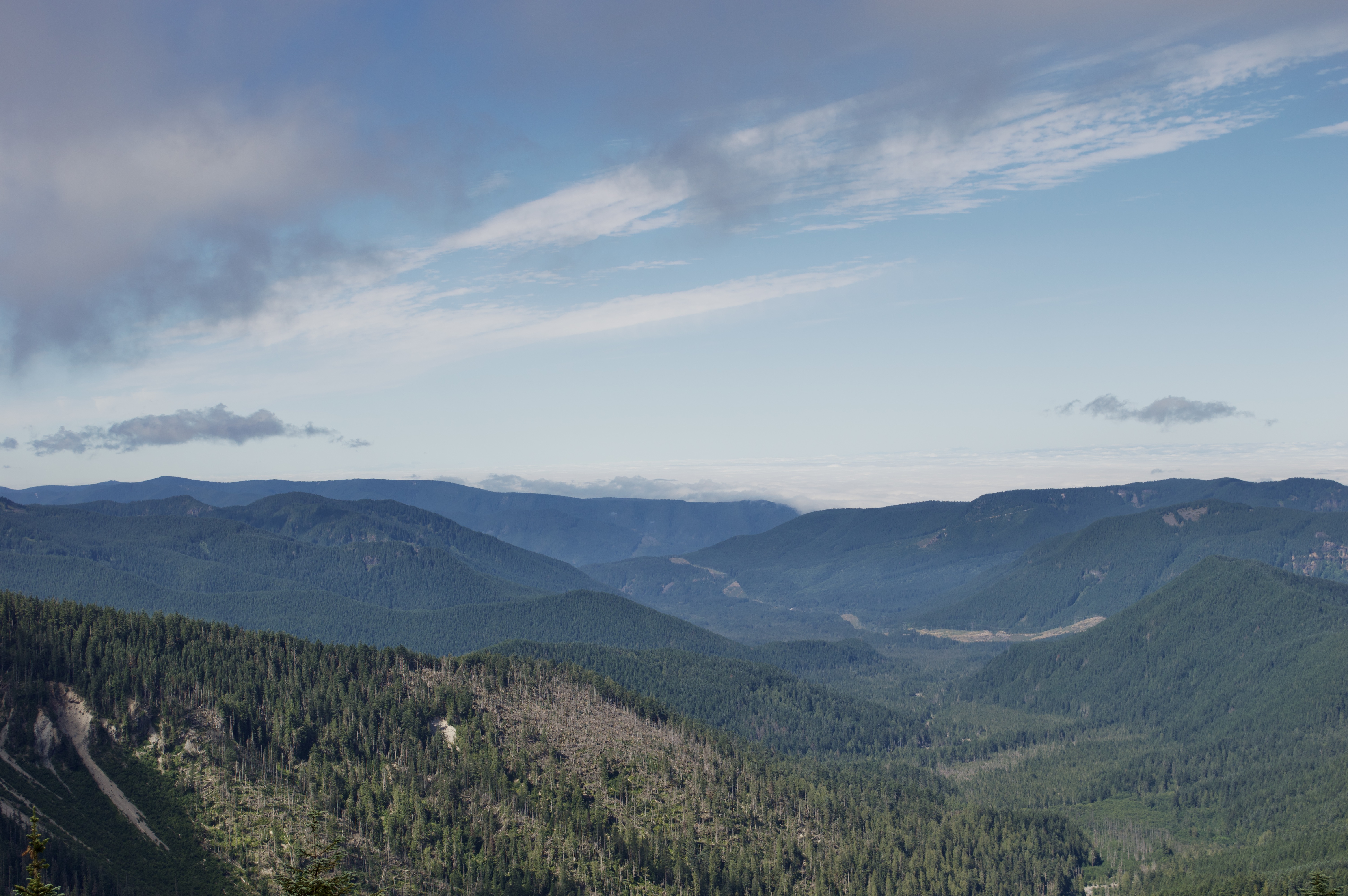
Don’t forget to look behind you, Bald Mountain offers a beautiful perspective on Mount Hood.
Whenever you feel ready, follow the trail back onto Timberline. You’ll be lead through Bald Mountain once more, and then on Top Spur. When you’re done, take the beautiful drive back through Lolo Pass and back from where you came.
Map Data
You can also download the gpx file for your GPS unit or watch or view it on Strava, where I created the route file.